Drones For Surveying
Of the many commercial uses of drones, mapping and surveying seem like some with the most natural fit. By using a drone, surveyors no longer need to spend several days or weeks walking through the survey area and taking manual measurements. Not only do drones make surveying jobs easier, but they can also produce data and models that are more accurate.
Surveying with a drone offers enormous potential to GIS professionals. With a drone, it is possible to carry out topographic surveys of the same quality as the highly accurate measurements collected by traditional methods, but in a fraction of the time. This substantially reduces the cost of a site survey and the workload of specialists in the field.
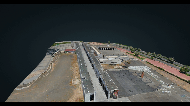
We can create geo-referenced orthomosaics, elevation models or 3D models of any project area. These maps can also be used to extract information such as highly-accurate distances or volumetric measurements. Unlike manned aircraft or satellite imagery, drones can fly at a much lower altitude, making the generation of high-resolution, high-accuracy data, much faster, less expensive and independent of atmospheric conditions such as cloud cover.
This data is processed and analysed in-house to create true to scale 3D point clouds models, DTM and DSM models, Orthomosaic, ortho-imagery, photos and , 360 degree tours along with a range of other deliverables.
The outputs can be delivered in industry standard formats or hosted on our secure online hosting platform.
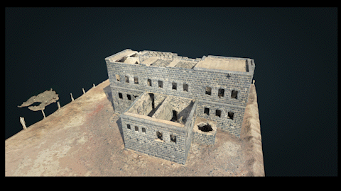
3D Textured Model
The 3D textured mesh is a reproduction of the edges, faces, vertices and texture of the area shot by the drone. This model is most useful for visual inspection or for when external stakeholders or public involvement is essential for a project.
3D Point Cloud
A densified point cloud can be generated from drone images. Each point contains geospatial (X, Y, Z) and color information. It provides a very accurate model for distance (slant and horizontal), area and volume measurements.
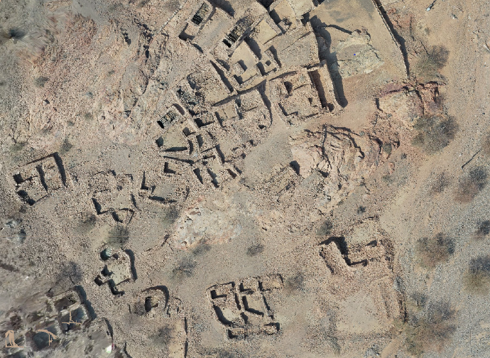
Orthomosaic Maps
Write one or two paragraphs describing your product or services. To be successful your content needs to be useful to your readers.
Start with the customer – find out what they want and give it to them.
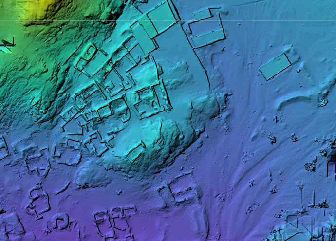
Digital Surface Model (DSM) Digital Terrain Model (DTM)
A form of surface model that includes all acquired points, representing natural and man-made features. A DSM includes the tops of buildings, trees, powerlines and other objects. In essence, it is a canopy model, and only sees the ground when nothing else is above it.
Digital Elevation Models, also known as DEMs, are a visual representation of the elevation data for every point captured on your site. Instead of depicting how your site actually appears in person, DEMs generally use colour to indicate differences in elevation.
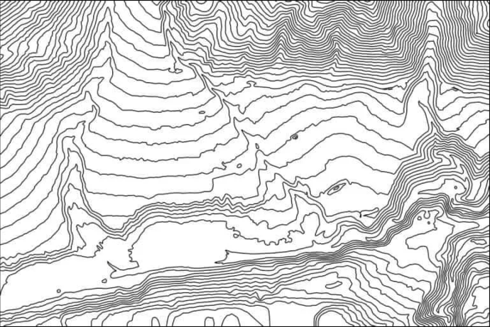
Contour Lines
Depending on the project requirements, either the DTM or DSM model, with custom contour intervals, can be used to create a contour lines map, giving you a better understanding of the surface of the area shot by the drone.
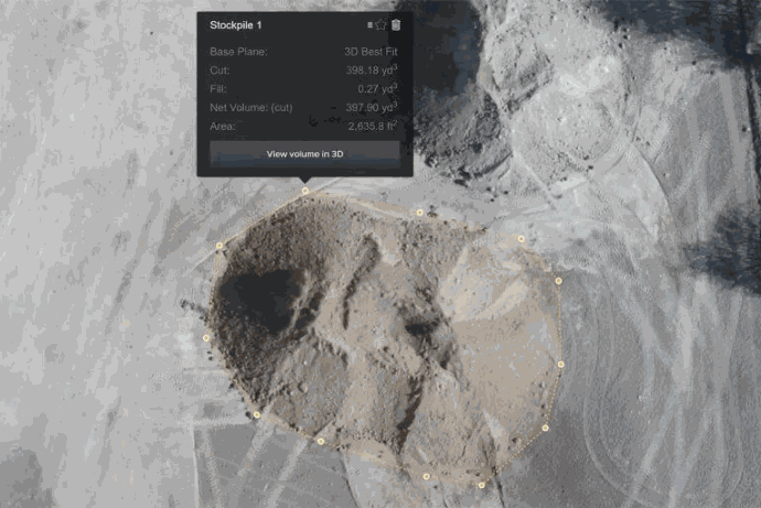
Stockpile Measurement
With 3D mapping software, it is also possible to obtain volumetric measurements from the very same images. This fast and inexpensive method of volume measurement is particularly useful to calculate stocks in mines and quarries for inventory or monitoring purposes.
With a drone, surveyors can capture many more topographic data points, hence more accurate volume measurements. They can also do this in a much safer way than if they had to manually capture the data by going up and down a stockpile. Since drones are capturing the data from above, operations on site won’t be interrupted. The short acquisition time enables capturing a site snapshot at a specific point in time.